Connectivity
Every mode. One address.
The physical link between deep-sea access and inland feedstock — the thing the most successful ports have, and greenfield sites spend a decade trying to build.
Marine
VLCC-capable, eleven miles from the Gulf
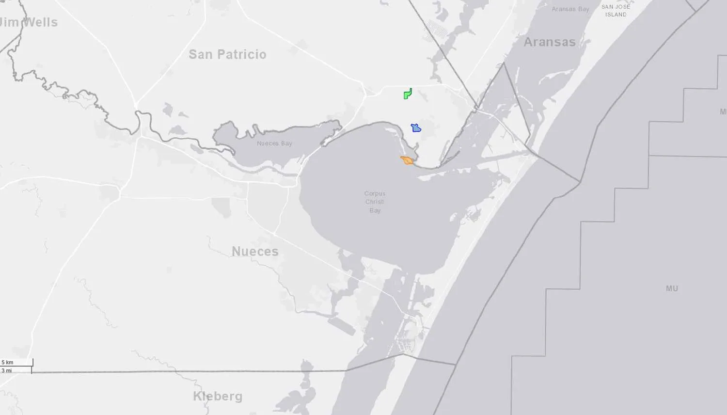
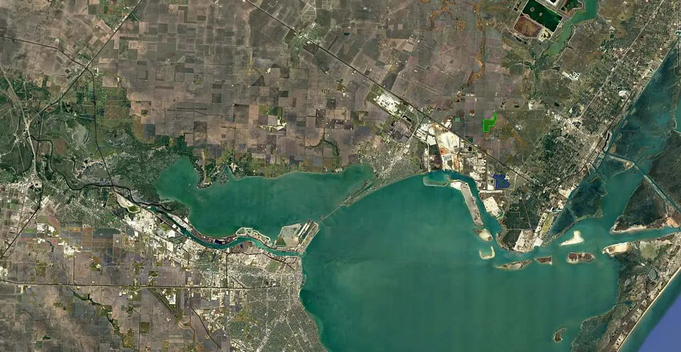
Six permitted VLCC docks on Berry Island, on a channel that already hosts the largest ships afloat — and the Port of Corpus Christi has recently completed its channel widening and deepening program, eliminating the downtime and construction delays of earlier years.
- Corpus Christi54 ft channel depthMaintained by the U.S. Army Corps of Engineers; 17% deeper than the Houston Ship Channel
- La Quinta47 ft, expected 54 ft by 2027Direct frontage at Berry Island
- Jewel Fulton17 ft — Berry Dock barge operations
- Distance to Gulf~11 miles from Ingleside~26 miles from the Inner Harbor · ~40 from Houston
- FeesTwo-fee structure (wharfage, dockage) versus four separate charges at Houston
Pipeline
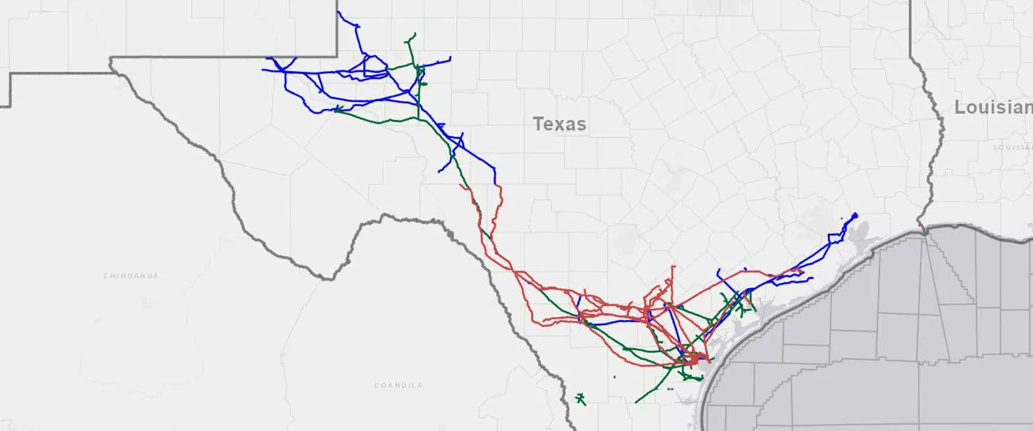
The nexus of Permian and Eagle Ford takeaway
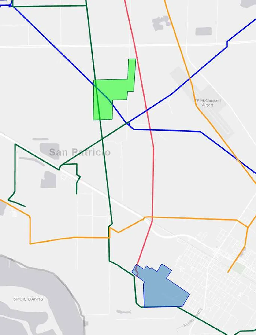
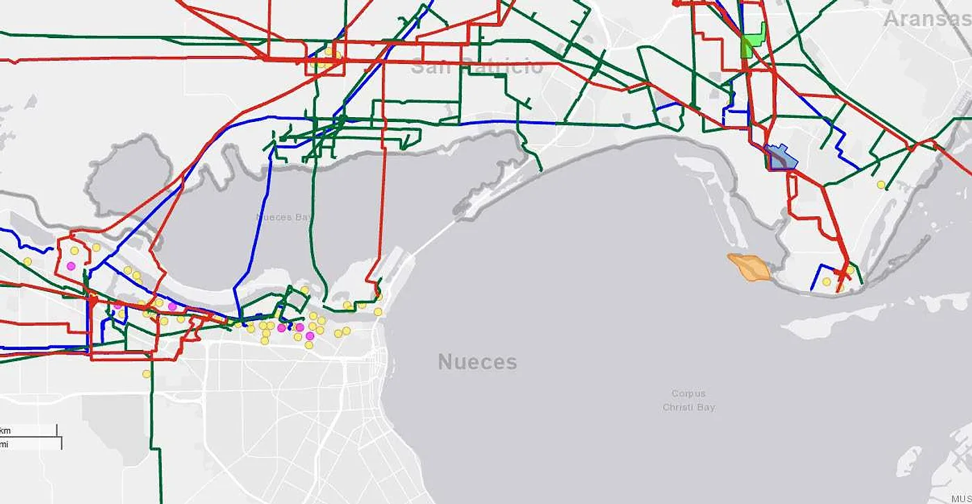
Crude, natural gas and NGL from the two premier U.S. basins and from Mont Belvieu run through or beside the tracts — 22+ potential connections, with rights-of-way already linking upland acreage to the deepwater docks. Corpus Christi-bound pipelines can service more than half of projected 2026 Permian and Eagle Ford crude supply.
Long-haul crude into Corpus Christi
| Pipeline | Capacity (MBbl/d) | Origin |
|---|---|---|
| Gray Oak | 1,020 | Eagle Ford & Permian |
| Cactus I & II | 390 | 670 | Permian |
| Cactus III (formerly EPIC) | 600 | Permian |
| Eagle Ford | 600 | Eagle Ford |
| Ingleside | 600 | Eagle Ford |
| Sunoco system | ~475 | Permian & Eagle Ford |
| North Crude system | — | Regional |
Natural gas
| KM Texas / Tejas | 9.3 Bcf/d |
| Gulf Coast Express | ~2.0 Bcf/d · expansion 2026 |
| Whistler | 2.0 Bcf/d |
| ADCC | 1.7 Bcf/d |
| Blackcomb | online 2026 |
NGL
| Sand Hills | 500 MBbl/d |
| Coastal Bend | 225 → 350 MBbl/d, expansion underway |
| BANGL | 250 → 300 MBbl/d, 2H 2026 |
| Shoup to Belvieu | — |
A merchant ethylene pipeline (Ingleside cracker to Markham storage) runs adjacent to the tracts. Sources: company materials, OPIS, Enverus.
Rail & road
Three Class I railroads. Uncongested highways.
The Exxon Tract and Expansion Acreage sit on the Union Pacific line with trackage rights for BNSF and Kansas City Southern — a competitive bidding environment that drives down freight costs and opens nationwide market access — and on major routes that avoid the bottlenecks common to Houston.
- RailUnion Pacific mainline through the tracts; BNSF and KCS trackage rightsPotential spur into the tracts; siding capacity for inbound feedstock and outbound product
- InterstateI-37 · I-69 corridor
- HighwaysUS 181 · SH 35 · SH 361 · SH 77 · SH 200 (approved route through the Exxon Tract)
- CorridorJoe Fulton International Trade Corridor
- Power20+ power plants in the Corpus Christi area; expansion of local generation planned100–161 kV transmission through the Exxon Tract and near the Expansion Acreage
- TradeForeign-Trade Zone #122