The site
Four tracts. One waterfront.
~1,500 acres owned free and clear, interconnected by pipeline easements and rights-of-way into a single contiguous platform with marine, pipeline, rail and highway connectivity. Ten years of assemblage; a hundred years of industrial use history.
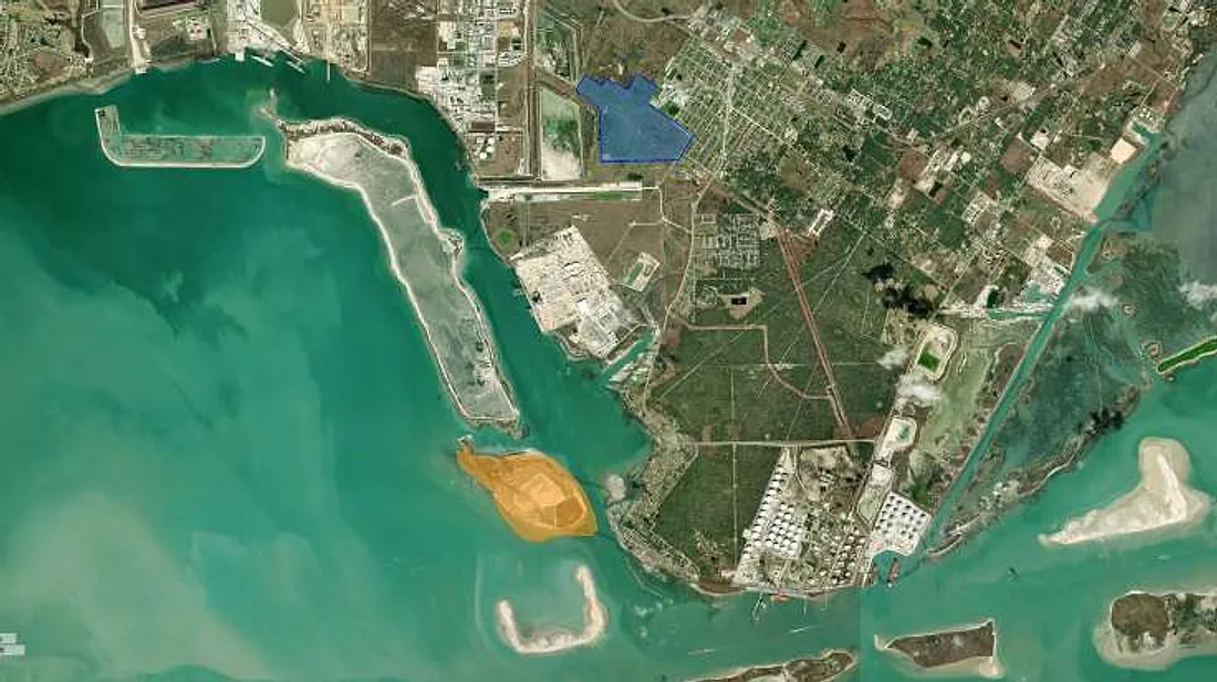
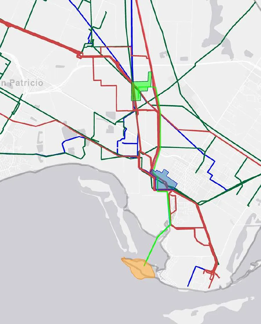
Tract 01 · ~225 acres
Berry Island
The deepwater heart of the platform: an island at the mouth of Corpus Christi Bay on the La Quinta Ship Channel, permitted by the U.S. Army Corps of Engineers for six VLCC docks. At 47 ft above sea level it sits among the highest elevations in San Patricio County.
Specification
- LocationMouth of Corpus Christi Bay, La Quinta Ship ChannelEleven miles from the open Gulf; ~15 nautical miles closer than the Inner Harbor
- Elevation47 ft above sea levelFlood protection and a working advantage in inclement weather
- ChannelLa Quinta: 47 ft today, 54 ft expected by 2027Corpus Christi Ship Channel: 54 ft, recently widened and deepened
- Dock permitsSix VLCC docks permitted (Corps of Engineers, 2025)Port development agreement provides for up to seven ship docks
- VesselsVLCC to ~320,000 DWT · LNG carriers · Suezmax · chemical tankersOne of only two VLCC-capable export sites on the Corpus Christi and La Quinta channels
- JurisdictionDe-annexed from the City of Corpus Christi (2017–2022)No municipal zoning restrictions; accelerated project timelines
- Port agreementsFranchise agreement with the Port of Corpus Christi including a “favored nations” clause on wharfage; development agreement (2023–2025) covering channel access and an easement over port submerged lands
- UtilitiesConduit easement agreement in place; two subsurface conduits already drilled under the La Quinta channel; a high-pressure natural-gas line from previous use on the property
- ShoreRiprap shore protection in place
- LinksPipeline and conduit easements to the mainland; ~0.2 miles by water from Berry Dock
The island today
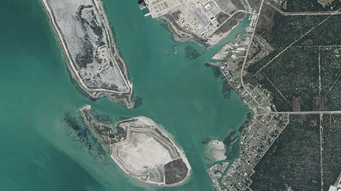
As permitted
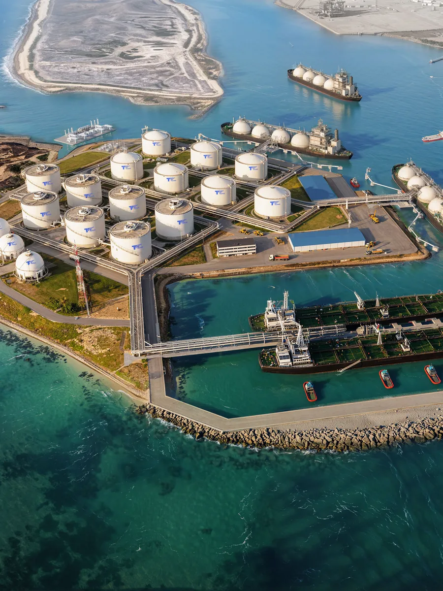
Tract 02 · ~5 acres
Berry Dock
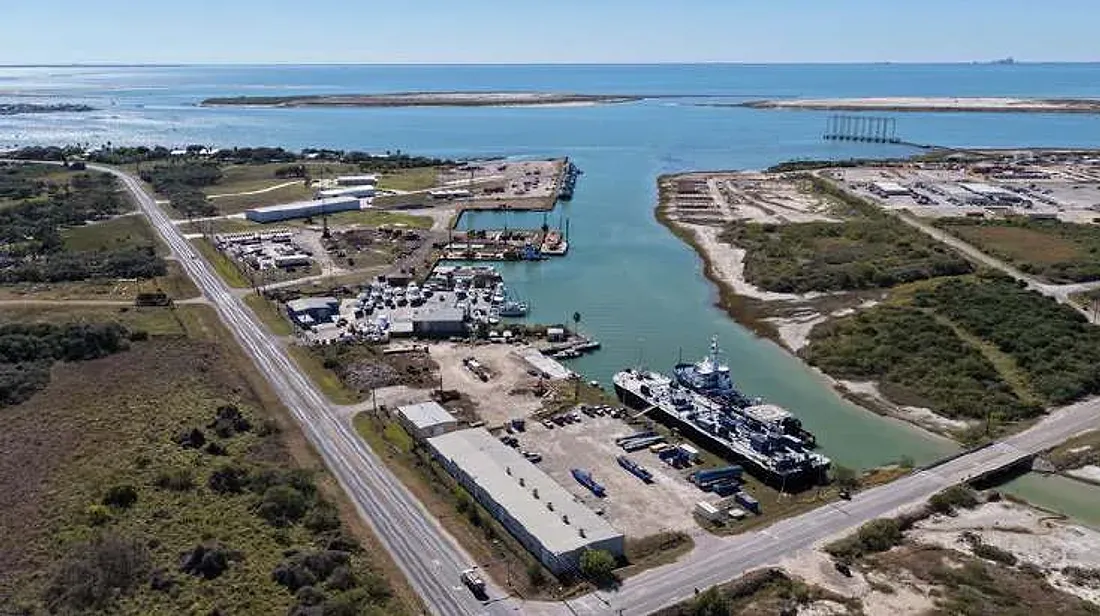
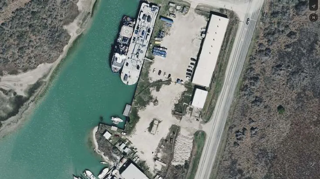
The mainland gateway to the island: an operational barge dock on the Jewel Fulton Channel with office and warehouse, a 0.2-mile crossing from Berry Island. Vessel staging, crew and equipment support, and the link between mainland and island operations.
Specification
- WaterJewel Fulton Channel — 17 ft depth · ~440 ft dock length
- DockOperational barge dock for commercial maritime operations and heavy cargoBulkhead construction finalised August 2025
- BuildingsAdministrative office · ~25,000 sq ft warehouse
- ZoningIndustrial waterfront
- RoleLogistics hub for Berry Island: personnel, marine logistics, cost-effective shipments to the island
- Acquired2001
Tract 03 · ~199 acres (+ ~89 in process)
Exxon Tract
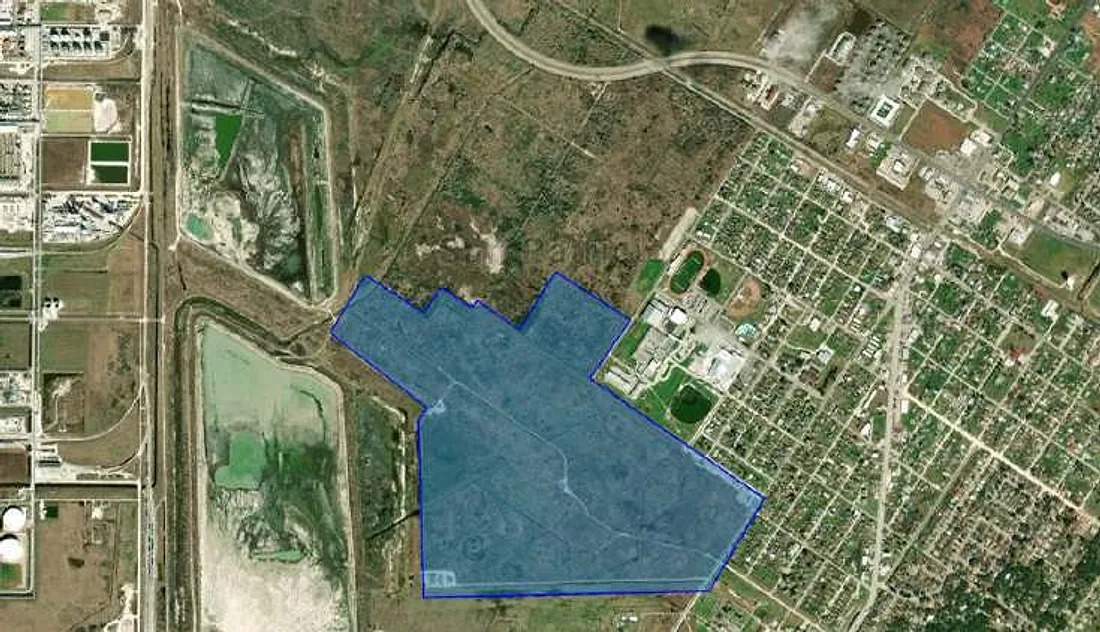
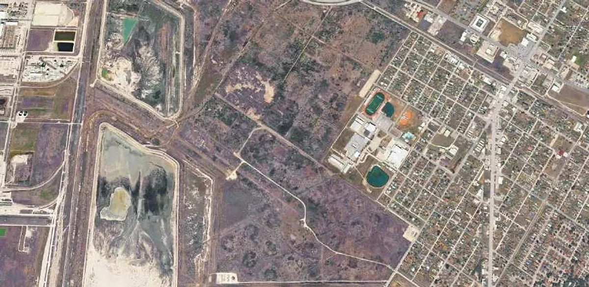
The former Humble Oil refinery and terminal site, now a shovel-ready industrial tract at the crossing point of the region's major pipelines. Industrial zoning with a Special Use permit allows immediate construction of a terminal or ~20 MMBbl tank farm.
Specification
- ZoningIndustrial, with a Special Use permit for a terminal or ~20 MMBbl tank farm (City of Ingleside, 2025)
- EnvironmentalTexas Railroad Commission Certificate of Completion, August 2025, under the voluntary cleanup program — storage tanks may be reconstructedSoil and groundwater assessment conducted 2012
- Tank layoutConceptual layout: 300 ft and 150 ft diameter tanks with a manifold and pipeline area
- Right-of-way~2.5 miles to Berry Island
- RailDirect access — Union Pacific mainline, with BNSF and KCS trackage rights; potential spur
- HighwayState Highway 200 approved route directly through the property; SH 361 directly north
- Power100–161 kV transmission line runs through the property and along the east boundary
- HistoryOption and remediation agreement 2015–2017; cleanup and acquisition 2017–2022
Expansion — ~89 additional acres
Wholly owned and legally segregated from the ~199-acre tract. 69 acres are remediated and await certification from the TCEQ; the remaining ~20 acres are a former impoundment area under active remediation by the previous owner at its contractual obligation. On certification the acreage connects the tract directly to SH 361 and supports a larger tank farm or other development.
Pipelines through or near the tract
| Line | Product | Diameter | Basin |
|---|---|---|---|
| Gray Oak | Crude | 30″ | Eagle Ford, Permian |
| Cactus II | Crude | 26″ | Permian |
| Cactus III (formerly EPIC) | Crude | 30″ | Permian |
| Moda Taft – Ingleside | Crude | 36″ | Eagle Ford, Permian |
| Ingleside Pipeline | Crude | 24″ | Eagle Ford |
| Viola | Crude | 20″ | Eagle Ford, Permian |
| Flint Hills system | Crude | — | Eagle Ford (via Pettus–Corpus) |
| Gregory · Southcross · Refugio–Ingleside · Ingleside | Natural gas | 5″–13″ | Eagle Ford, Haynesville |
| Ethane (2) · LPG (1) | NGL | — | Mont Belvieu network |
Six crude, six natural-gas, two ethane and one LPG line run through or near the tract. Connection subject to owner agreement.
Tract 04 · ~1,070 acres
Expansion Acreage
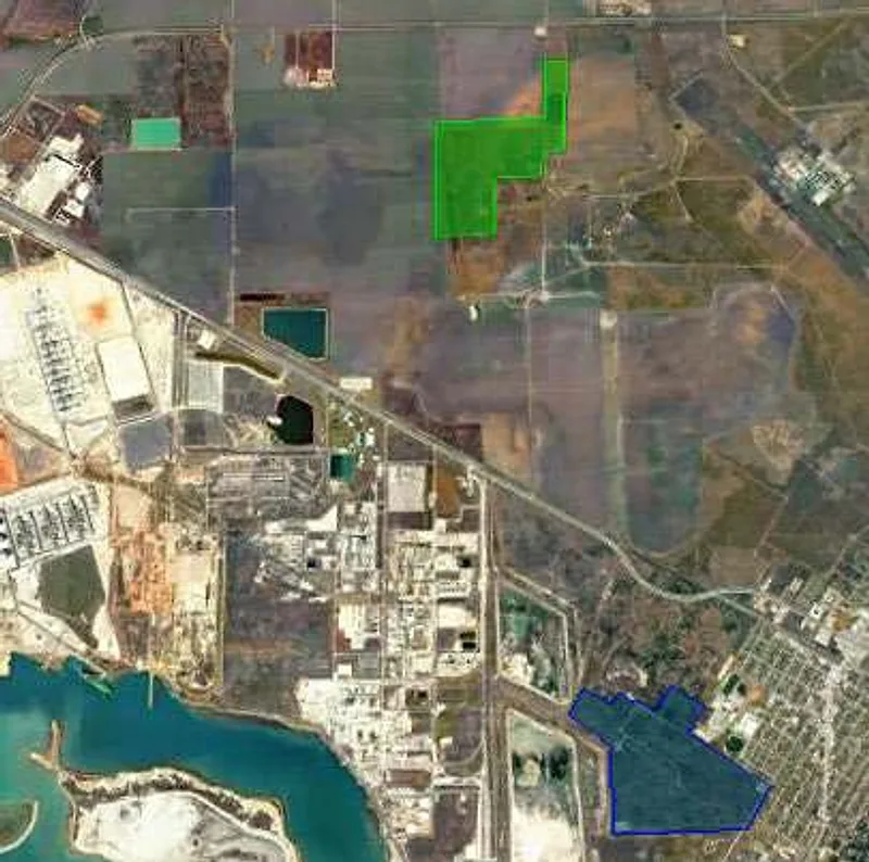
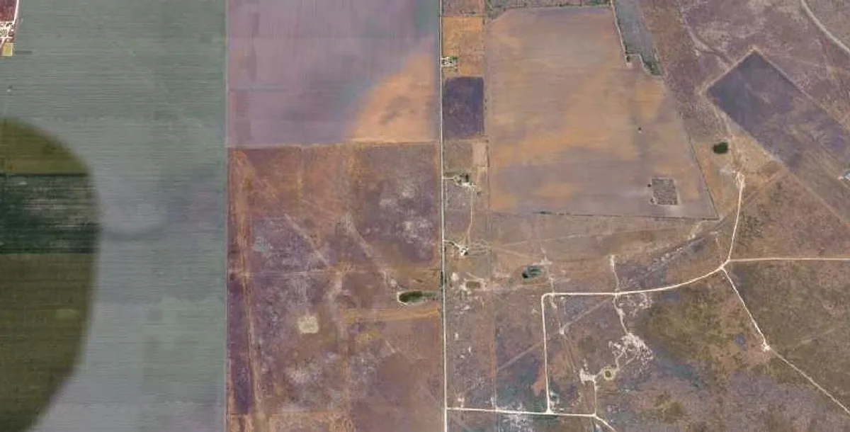
Unrestricted greenfield industrial land at the intersection of supply and demand — rail, highway and pipeline access, no residential neighbors, and permitting that supports a ~10 MMBbl tank farm complementing Berry Island.
Specification
- ZoningIndustrial; not annexed — no zoning restrictionsOptioned 2025
- NeighborsNo direct residential neighbors; ~3 miles from town
- CapacityPermitting supports a ~10 MMBbl tank farmConceptual layout: 250 ft, 200 ft and 170 ft diameter tanks
- PipelinesFive crude, two natural-gas and four high-volatility-liquid (HVL) lines through or near the tract
- Right-of-way~6.9 miles to Berry Island
- RailDirect access — Union Pacific, with BNSF and KCS trackage rights
- HighwaySH 35 ~300 m north · SH 361 ~1 mile south
- PowerNearby 100–161 kV transmission
- BufferRoom for the safety zones ammonia and methanol production require
Timeline
From raw land to shovel-ready
A decade of assemblage, remediation, de-annexation and permitting — timed to the two basins and the lifting of the export ban.
- 1997
Acquisition of Berry Island.
- 2001
Acquisition of Berry Dock. Dredge-material placement agreement signed for the island.
- 2008 · 2010
Eagle Ford and Permian shale discoveries reshape Gulf Coast supply.
- 2015
United States lifts the crude-oil export ban.
- 2015 – 2017
Exxon Tract option and remediation agreement negotiated and signed.
- 2017 – 2022
Exxon Tract cleanup and acquisition. Berry Island de-annexed by the City of Corpus Christi.
- 2023 – 2025
Berry Island development agreement with the Port of Corpus Christi: up to seven ship docks, La Quinta channel access, easement over port submerged lands, pipeline and conduit easements, franchise with favored-nations clause.
- 2025
Corps of Engineers permit issued for six VLCC docks. RRC Certificate of Completion on the Exxon Tract; industrial zoning and Special Use permit from the City of Ingleside. Expansion Acreage optioned. Berry Dock bulkhead completed.
- 2026 →
Ready for development.